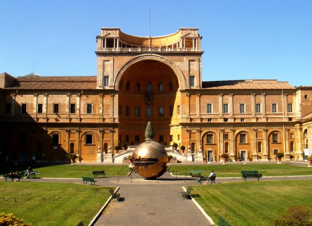
- Address: Cortile del Belvedere, 00120, Vatican City
- Reason: 1578-1580 years.
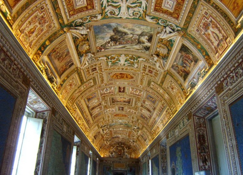
It is impossible to fully get acquainted and appreciate the cultural and historical life of the Vatican without visiting the Gallery of Geographic Maps. It was formed at the end of the 16th century and was a specially built up floor in the Pope's palace. The gallery of geographical maps of the Vatican was a symbol of the absolute authority of the church in the person of the Pope.
History of the creation of the Geographic Map Gallery
At the invitation of Pope Gregory XIII in 1580, a famous cartographer and talented mathematician Ignazio Danti arrived in Rome. Soon Danti is appointed personal mathematician of the pope and becomes a member of the commission on changing the calendar, which, incidentally, we use so far. In addition, artists are invited, whose task is to paint the frescoed room and show on maps of Italy and all of its parts that were under the power of the pope. This work lasted almost three years.
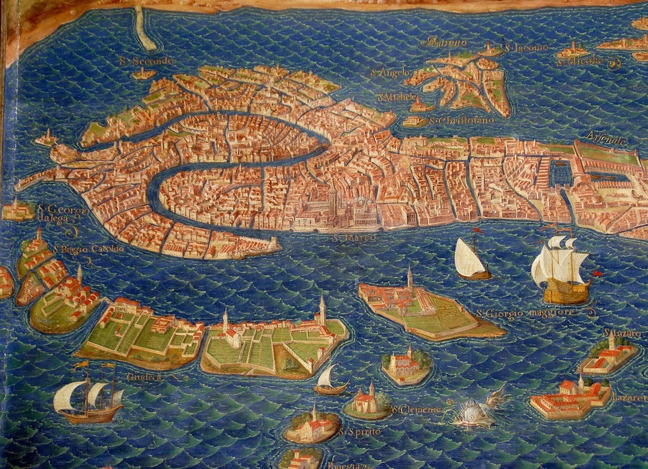
The result of the painstaking work was forty frescoes depicting the Apennine peninsula and its coastline with the leading ports and cities. Only at first glance the gallery carried an important geographical meaning, the political idea meant much more. After all, at this time, popular discontent was growing and the clergy had to exert much more effort to retain power in their hands. This is considered the main reason why the Gallery of geographical maps in the Vatican added Avignon, as one of the lost residences of the popes; a map that is managed by Spain Corsica, Sicily, Sardinia.
The main goal of the Vatican Geographic Map Gallery was to show the world that only the church of Rome is the only possible kingdom of God in the earth. To convince doubting critics, the author invented a brilliant trick. When you exit the gallery on the left you can see a fresco called "Italy antique", while the "Italy New" map flaunts right on the right. When comparing the two frescos it becomes clear that the scale and grandeur of the "New Italy" are incomparable with the antique and make it the only heiress of the empire.
Even without going into the political life of that time, any tourist is able to assess the significance of the Gallery of geographical maps in the Vatican. Each card is unique in its kind and carries a lot of useful information about the cities of Italy in the XVI century, interesting features of the provinces, and the most attentive, perhaps, will be able to understand and the person who lived in that era.
Information for visitors
To get on an excursion to the Pontifical Palace , you need to buy a ticket, the cost of which is 16 euros. If you want to see the exhibits of the Geographic Map Gallery alone, you can buy an audio guide that costs about 7 euros.
The mode of the gallery is quite comfortable: from 9 am to 6 pm. It should be noted that the ticket office is open until 16:00, so if you are planning an evening tour, it is better to buy tickets in advance.
To get to the gallery, use the services of the metro. So you will go to St. Peter's Square . The station you need is S.Pietro, Cipro.
| | | |